Directions to the Project Kuckucksmühle

The Address
Kuckucksmuehle
Ausbau 7
16909 Heiligengrabe
(Brandenburg)
Germany
Coordinates
By Train
Nearest Train Station is Liebenthal(OPR) (7km) sometimes written as Liebenthal(Prignitz) - For that Train you have to push the “Stop(p)” button, otherwise it may not stop.
For late arrivals (till 22:00) Wittstock(Dosse) is also not that far (10km) and on the same route as Liebenthal(OPR).
In some rare/awkward cases Blumenthal(Mark) is also possible, it's on a different route and only drives a few times a day (7km).
You can plan your train ride with this website.
By Car
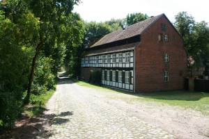
Leave the Highway (A24) on exit 21. If you come from Berlin, turn left after exit or if you come from Hamburg/Rostock, turn right after the exit and drive to the village Herzsprung. Turn left on L14 to 'Kyritz' and right after the end of the village (still Herzsprung) to Koenigsberg/Blumenthal/Grabow. In Grabow take the second right (Middle of the village/Oaktree) then turn left at the end to leave the village. Follow the road for about 4 Kilometers (be aware of the speed limit 50! and 30!; animals and children may cross the street and other cars can appear after each curve) and when the road turns into cobblestone you are in front of the mill.
Next to it you see a lot of space to park. Don't park in front of the gate. This space is needed for the fire department in case of a fire hazard.
by Bike or Hitchhike
To arrive on your own, use the OSM Bicycle map. Navigation systems help you to reach Grabow or Blandikow, but they often do not know about the road to follow. Please look at the map before you leave, it is possible that you cannot load it due to bad mobile reception.
Also interesting to read: Conditions for a visit at Kuckucksmuehle
operating instructions
Various functions are available as part of the map.
mouse/touch operation
- moving by grabbing the map with a mouse-click you can move the map around
- overview map using the < button in the bottom right of the map you can expand an overview map
- zooming in and out using the + and - buttons in the top left of the map you can obtain more or less detail in the map
- switching themes or maps clicking on the ≡ icon on the right-hand side of the map you can view and select available maps and themes
- retrieving information the map may contain elements that contain more information, by clicking these a popup will show this information
- fullscreen display using the ⛶ button the map can be maximized to fullscreen display, use the ▢ button to return to page display.
keyboard operation
Keyboard operation becomes available after activating the map using the tab key (the map will show a focus indicator ring).
- moving using the arrow keys you can move the map
- overview map using the + button in the bottom right of the map you can expand an overview map
- zooming in and out using the + and - buttons in the top left of the map or by using the + and - keys you can obtain more or less detail in the map
- switching themes or maps clicking on the ≡ icon on the right-hand side of the map you can view and select available maps and themes
- retrieving information the map may contain elements that contain more information, using the i key you can activate a cursor that may be moved using the arrow keys, pressing the enter will execute an information retrieval. press the i or the escape key to return to navigation mode
- fullscreen display using the ⛶ button the map can be maximized to fullscreen display, use the ▢ button to return to page display.
It's possible that some of the functions or buttons describe above have been disabled by the page author or the administrator

| id | symbol | latitude | longitude | description |
|---|---|---|---|---|
| 1 | 53.10347º | 12.40463º |